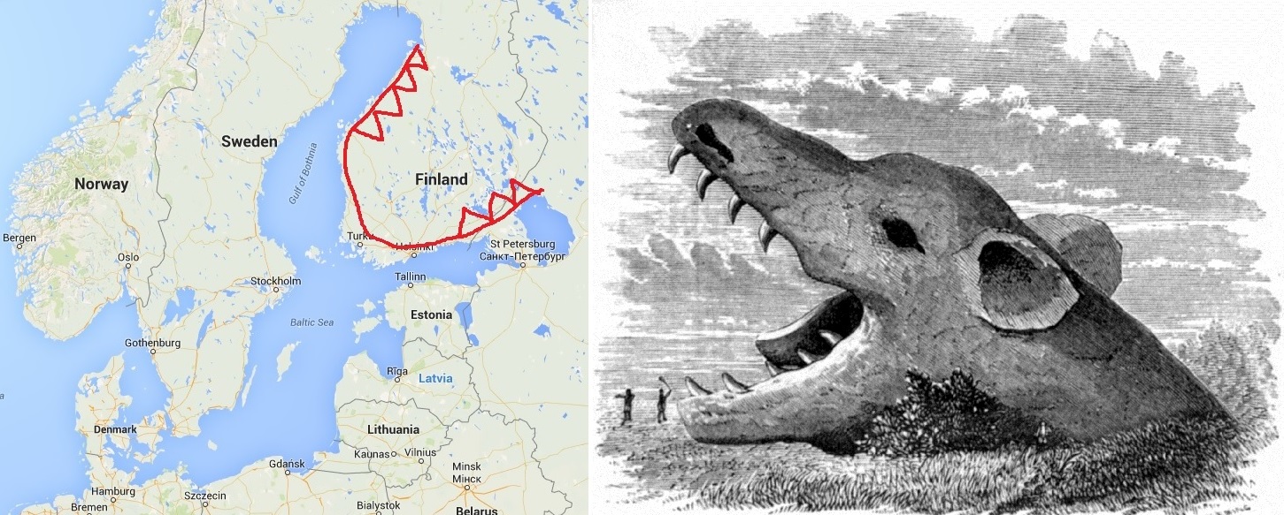
An often-used Finnish metaphor is surman suuhun “into Surma’s mouth“
In further strengthening my case that the myth behind Fenrir\Surma\Garm is based off of a geographical series of waterways surrounding Finland, I will look to deepen the previous connections made between this land area and the FSG Myth. To prove even more conclusively, that these followup or additional findings would not of been possible, without using my “watery” interpretation of the FSG Myth.
This post will cover FSG’s Famously depicted “Mouth”. I will show you several historical depictions of FSG throughout time and the common theme of FSG’s mouth wide open. Which I believe are all direct “shout out’s” to this land image. I haven’t researched the commonly accepted theories on the widespread use of FSG’s wide open mouth pose, but I plan to, as it could further prove or disprove my premise. Or maybe I’ll do it for the lulz as these interpretations or theories, are now a hoot to read.
Before we dive head first into the images, I wanted to introduce another relevant piece of the FSG Tale. The below excerpt is from ch.34 of the Gylfaginning, it reads:
They thrust a sword into his mouth so that the hilt touches the lower gums and the sword-point the upper gums–that is his gag. He howls horribly and slaver runs out of his mouth
We can now see where the origin of the “mouth open” portrayals come from and why it has been so widely used to depict FSG throughout history.
In beginning and to recap, when you see FSG’s “mouth” depicted below, think the mouth area of the above Google Map Image.
Starting with the below historical rendering, this FSG depiction was published in 1874 by A. Fleming. As you can see, the “mouth” area is depicted in such a way, that it dominates and demands ones attention. It is the main theme of this “map” or Artwork. I said map because I was able to again, read this like a map and further connect additional circumstantial pieces.
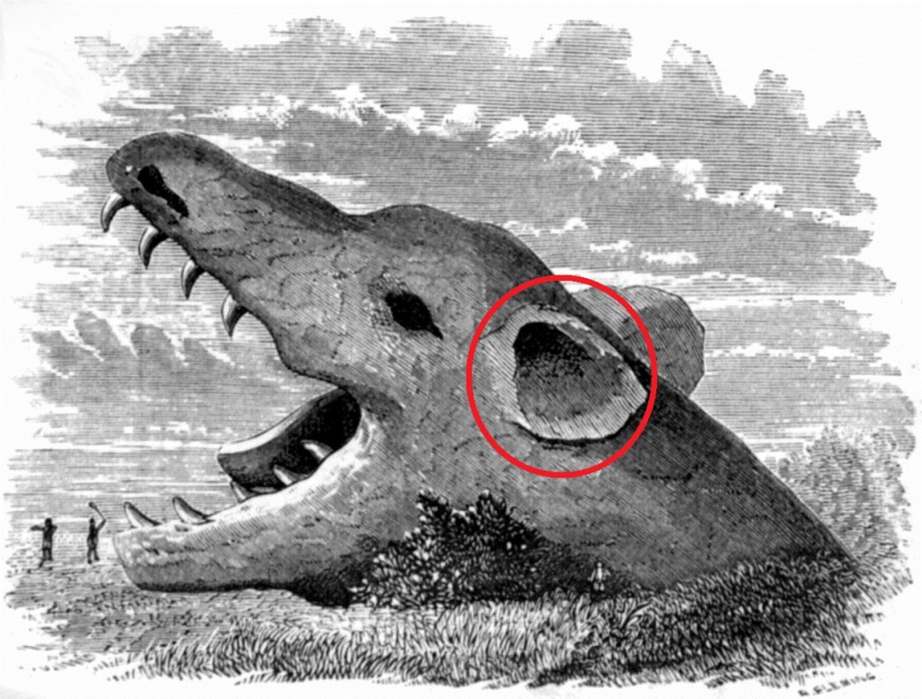
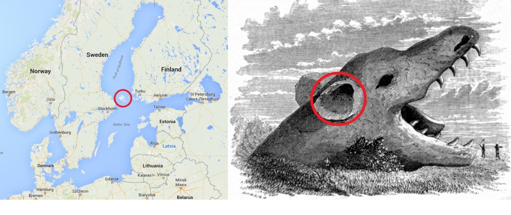
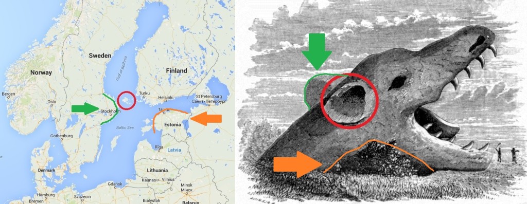
For example, I believe I have identified the real-life representation behind the “Ear” area being depicted in this image. See the below highlighted area:
Interpreting this image as a “map”, my first thought was the “ear” area, looked like an island (land) surround by a water ring, then back to the darker textured area of FSG’s head. My next thought was, is there an Island located directly behind FSG’s Google map “mouth”? There is…Aland Islands.
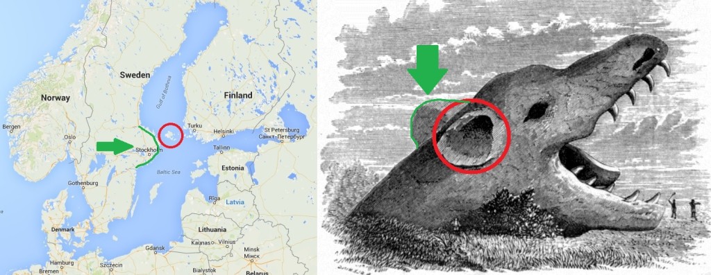
In further dissecting the above image, notice the round hump-like stone protruding from behind FSG’s ear in the image on the right. The hump-like area by Stockholm on the left hand side map seems inplay even though its inverted. See the Green area highlighted below:
Why so many features matching up? What does it possibly all mean? It means its a map. A map with even more interesting and unique features to point out, as I found yet another intriguing area that seemed to match up with the Google map image of FSG. Specifically, the textured area by the back portion of FSG’s lower mouth and presumed “neck” area. Taking that, I went to the Google Map Image looking for a land area that kinda looks like its “eating into” or obstructing a portion of FSG’s lower back jaw. See below in Orange:
I am going to end the post right about here. Well, with one last dissection below. I will whip up a Part 2 and continue on with the remainder of these historical FSG images.
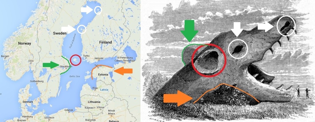
Finishing off (for now) the A. Fleming depiction, four possible map connections have been identified and appear to match. Open mouth, Ear, Hump and Lower Jaw obstruction. The last two I would like to cover, are the areas representing the “Eye” and the “Nostril”. Applying my “reading a map” mindset, these areas would be “land” areas or more Islands, within this watery enclosure. From the below map image, I have circled two islands (in White) along the lower edge of the Upper Jaw. The island highlighted furthest North of the Upper Jaw is Hailuoto and would signify the “Nostril” area. The other island, to the South, Borrskaret has not been researched enough to draw a definitive “its the Eye” conclusion. I believe it could represent the “Eye” region of the Art portrait, purely because there are no other land features or island areas anywhere near an assumed “Eye” area. Pretty much meaning its this or no “Eye” connection to be made here. I will research further along with Hailuoto and update this when completed.
Continue here for the second part of this series.
