In the ICWUDT – Fenrirs Binding installment, the “bindings” were hypothesized to mean, Country Boundary lines. In this installment, I want to “hypothesize” the meaning of Fenrir\Surma\Garm’s (FSG) Drool.
Why?
Not sure why, maybe because its specifically mentioned and written about in several sacred mythological texts. The inspiration for two historically significant pieces of Art. Could be because the “Binding” part of this Myth led me to an actual rock\boulder and I was willing to bet all on Black again? Wager all on this Myth being based off of the Geographical land area I have identified? Yup and yep. Now lets get started.
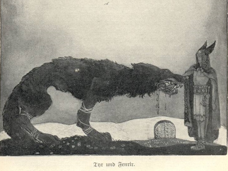
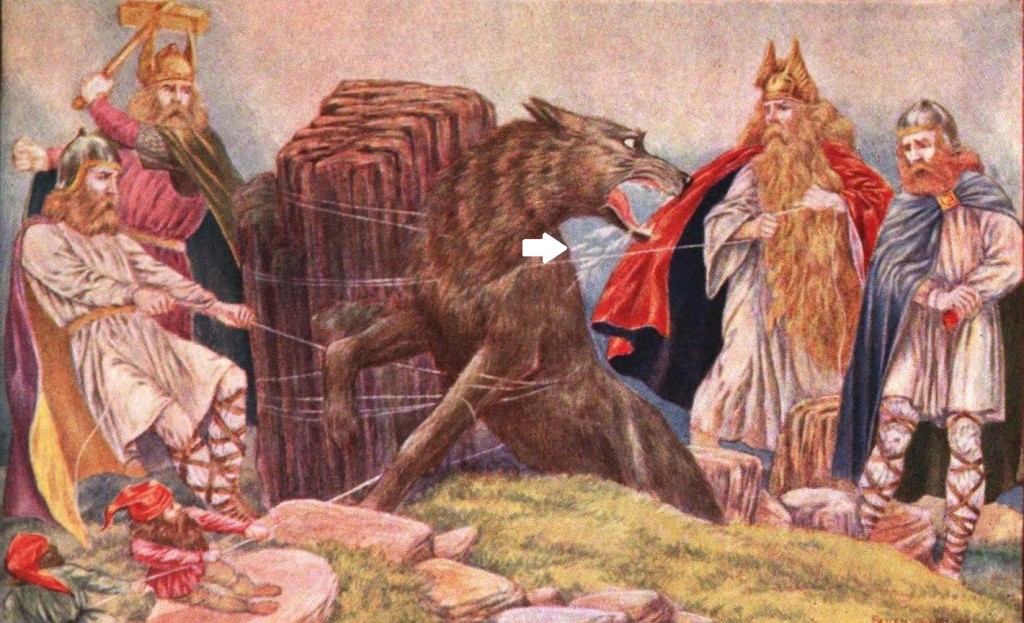
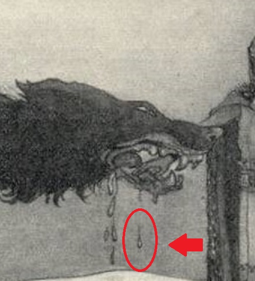
In the two historical “drool” portrayals I have found, there are two streams of drool depicted. This post will cover one of those two “drool” streams. The stream closest to the back of the mouth. I will cover the second stream in Part 2 of this series. In starting this segment, I’d like to provide a little mythological context to what I will be discussing in this post. In the below passage, the events surrounding FSG’s “drool” are outlined:
The wolf opened his mouth to a frightful width and struggled violently, wanting to bite them. Then they shoved a sword into his mouth so that the hilt was in its lower jaw and the point in the upper; that is his gag. He howls horribly, and the slaver running from his mouth forms the river called Vón (“expectation”)
1. Below you will find the two historical renderings of FSG. In each depiction, I have highlighted the first “slaver\drool” stream:
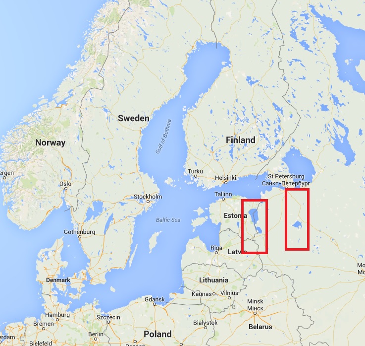
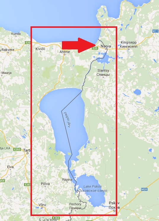
2. Being that slaver\drool is a water based liquid, I was pretty certain I would be looking for a water based land feature. In taking the Google Map image and placing it side by side with the above depiction of FSG, I wanted to approximate the locations of the drool\slaver streams. In the below map image, zoomed out to a high level, I have highlighted two areas that I believe could represent the two “drool” streams. Notice from this height, no other options exist below the lower mouth of this image. Its these two areas or nada su nada with my “drool” hunch.
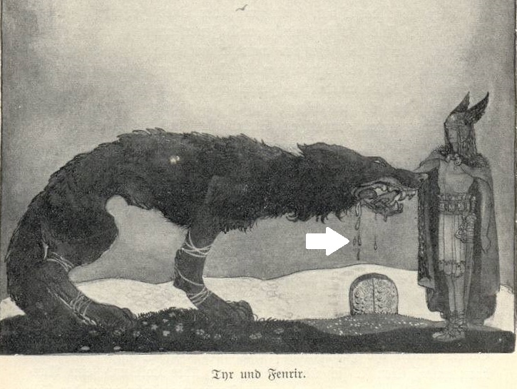
The reason I believe the right most red box is also a drool stream and therefore properly highlighted\identified, is because its in the depiction. See the cropped in image below with the single “drool” stream highlighted. This will be covered in the second part but thought it was worth further mentioning. Method to my madness type of deal.
2. Now that I have identified this drool stream, I needed to satisfy the next requirement in my “finding” process. Need some significance. Need something to be special about this area or lines of thinking end. If you recall from the myth excerpt I provided, the slaver “forms the river called Vón“. The river name is spelled “Von” here but is spelled “Van” in several other places. I take them to be interchangeable. In the following, I researched and discovered against “Van”. In saying that, I am keeping my eye out for anything “Van” in researching further this “drool” stream.
3. Zooming in on the identified area, I notice immediately a riverway leading into a much larger body of water. All within the area of the identified drool stream. The river is called Narva. Theres alot of “Van” in Narva. Van-ra to be exact when rearranging the letters. Is this? Could it be? See below for area in question:
Sadly, my research ends for this topic here. Is this the mythological river Van? Cant be a 100% certain but I am finding these coincidences encouraging and worthy of further pursuit. So be sure to check for more to this story and for Part 2. Be “Well”.
Continue reading Part 2 here
