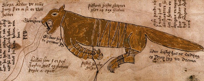
The following is a nice summation of the events surrounding Fenrir\Surma\Garm‘s Mythological “Binding” story:
Fenrir continued to grow till the Aesir feared him greatly. After several failed attempts, they ultimately created a fetter named Gleipner made of the sound of a cat’s footfall, the beard of a woman, the roots of a mountain, sinews of a bear, the breath of a fish, and the spittle of a bird. He was tricked into the bind as Tyr promised no harm would come if he allowed them to put it on and as a show of good faith Fenrir asked that Tyr place his hand in his mouth. Of course, the binding worked and captured the wolf who then bit off Tyr’s hand for the deception.
The Aesir then took a string called Gelgja\Gleipnir and tied that to a rock called Gjöll. They then took a rock called Thvti and used this as an anchor to hold Gjöll\Gioll even more firmly. Fenrir reacted and began trying to bite his captors who impaled his muzzle into the ground with a sword. The saliva that streams from his mouth has become the river Van.
In applying this to what has been proposed, that FSG (Fenrir\Surma\Garm) is a water based, geographical land feature. We can start deciphering the above “Binding” scene. And in deciphering this scene, I will further prove my theory that FSG is indeed the watery area I have identified. By employing this ideological framework as my base, I will take the above historical depiction of FSG, turn it into a map and find the mythical stone bindings of FSG.
Here is how I was able to find “Gjoll\Gioll” the mythical rock to which FSG is bound:
1. I interpreted the following image of FSG by A. Fleming (1874) in the following ways; the body of the image (deep brown shaded areas) as water and the bindings by the feet of FSG, running off the bottom of the page, as possible rivers. Rivers that are depicted as intersecting at the point they are bound to the stone or Gjoll\Gioll. I have highlighted this area in the picture below.
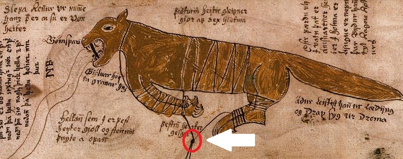
2. Next I went back to the Google Map Image of FSG and placed both images side by side. What I was now looking for, was a land pattern (rivers) running from out the underside or belly, that matched the above depicted “V” like shape of the bindings. From comparing the images, the belly or midsection area appeared to comprise the eastern shores of the Baltic Sea. See image below.
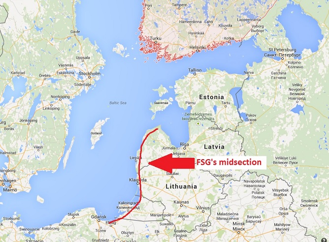
3. By honing in on the above area, I found what I thought was an interesting match to the “V” shaped depiction of the “Bindings”. Even though I was looking for an intersecting rivers feature, for no reason in particular, these land boundary lines proved to be an interesting substitute for the “Binds”. Be it rivers, land boundaries or dog sled trails, whatever I decide to use, for whatever reason, if it does not end in a “Real” Mythological Rock, this whole line of thinking gets flushed.
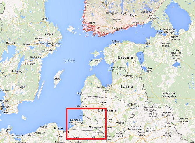
4. Now that I have identified the area, I decided to investigate the boundary map lines a little further. Who am I kidding, investigating further?? Lol, I made a B-line for that intersecting spot quicker than you can say Usain Bolt. Because at this point in my research, I was making logically notable findings left and right. And if I were a betting man, I would of mortgaged the farm on finding something “rockish” at the end of this rainbow.
5. Below you will find the area in question. The intersecting point of these two map boundary lines noted above. From the below image, nothing was directly present at the point of intersection from this level. So I zoomed in a little further.
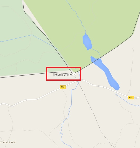
Sing it with me; “Do you “see” what I see, a star a….rock?? It was from this vantage point that I saw those heart bursting letters…G…R…A…N….I…C. GRANIC. I believe its Polish but whatever the language, my English read GRANITE! As in “I am looking for a rock” granite!! Hard to contain any enthusiasm at this point as I fully believe “Granic” will translate into something rockish here.
So who or what is this “Trojstyk Granic”? See below. While you are WOOOOWing, I’ve got an exploding heart thingamajigga I need to attend to:
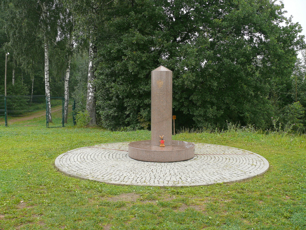
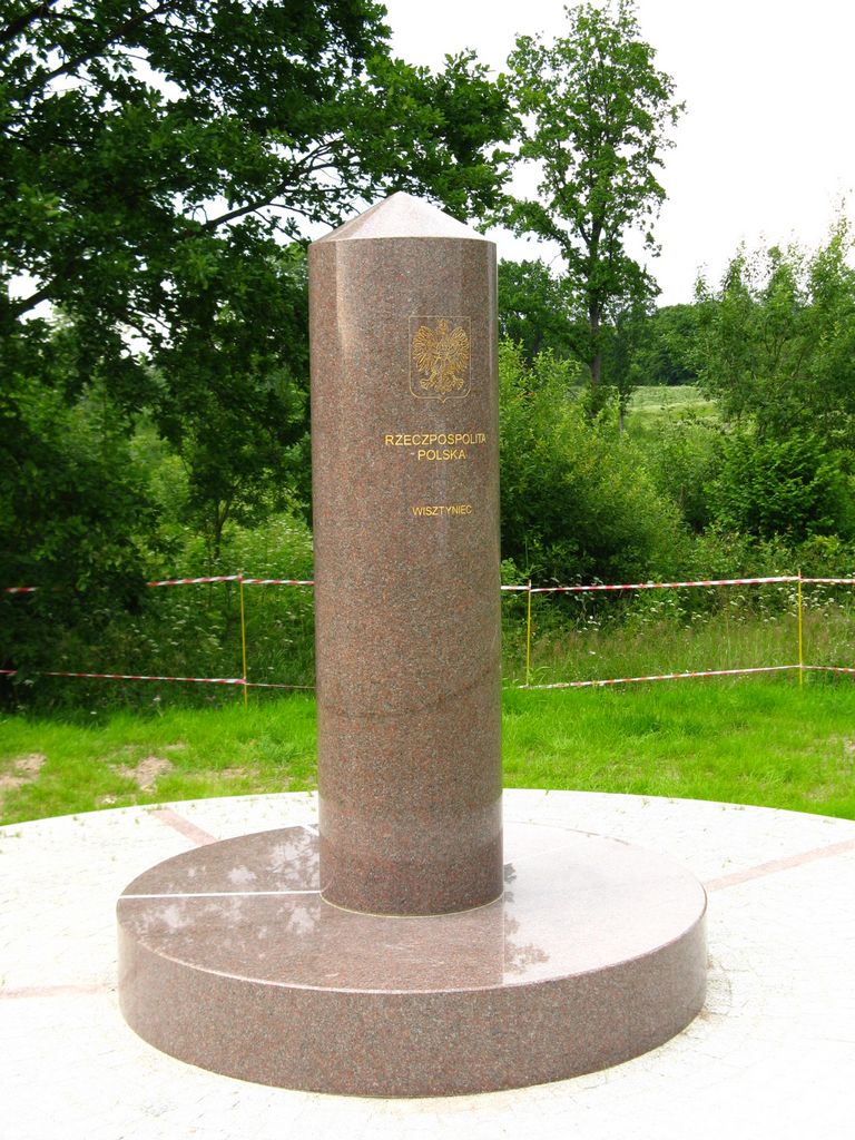
That is Trojstyk Granic. Trojstyk translates to “Tripoint”. With both words meaning Granite Tripoint. Essentially a tripoint is an intersection of three Countries boundaries lines. Dedicating a memorial to this tri-section, makes me think Trojstyks are important. Not to mention being located at the exact point that I am looking for a mythical “rock”! See a closer up view below:
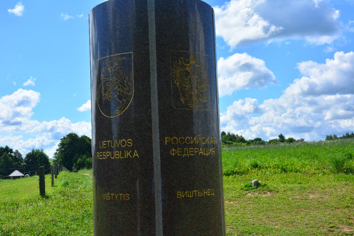
Below is one last image that clearly depicts the word “Vistytis” etched onto one side of this three paneled monument.
Remember this as we have a second rock to find nearby to satisy the stated passage. Here is that passage again:
“The Aesir then took a string called Gelgja\Gleipnir and tied that to a rock called Gjöll. They then took a rock called Thvti and used this as an anchor to hold Gjöll\Gioll even more firmly”
If Trojstyk Granic is Gjoll then a second rock Thvti should be found nearby to satisfy the depiction in the above passage. So I moved forward with looking for anything of significance nearby. And from the image, you can see a large lake area immediately to the north of the intersection. This is Lake Vistytis. The same “Vistytis” etched into the Trojstyk Granic.
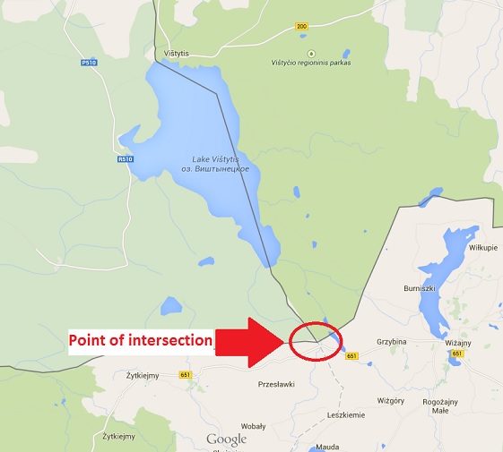
6. At this point I fired up the Google Machine and searched Lake Vistytis. The first two search items returned were Wiki pages of Lake Vistytis and the Town of Vistytis. Nothing “rockish” was gleened from the Lake Vistytis Wiki, so I moved onto the Town of Vistynis Wiki. See below for screenshot of Town of Vistytis Wiki page:
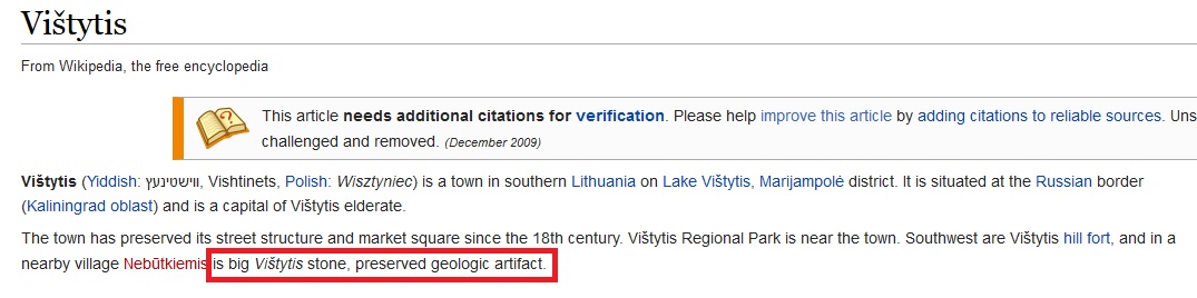
7. Jenga!! Vistytis Stone or Thvti??? See image below.
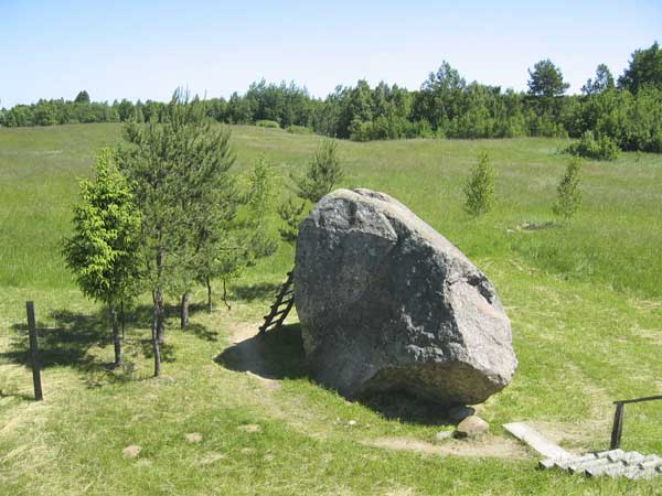
Is “Vistytis” the clue that subtlety links this “rock” to the Trojstyk Granic Gjoll” rock? Thus satisfying the Surma/Fenrir myth? Maybe, though right now it seems extremely promising, I have further vetting and research to do. There will be more to this. Check back for future updates!
Continue reading the next chapter in this Surma/Fenrir series here